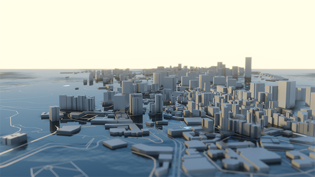
While the concept of city planning is not a new one, the strategies that we’re using in modern society to create the cities of tomorrow are evolving along with technology. Decisions that are made when designing a city will have enormous implications for decades to come. Still, with the aid of 3D modeling capabilities, virtual technologies, and simulations, cities are becoming smarter by the day. Do you know? – The Array of Things (AOT) in Chicago can monitor and respond to situations like traffic, flood, or other specified situations without much human intervention. There are many such smart cities, such as Singapore, New York, Boston, and San Francisco, etc. Smart cities make services more streamlined, ensure adequate resources for everyone’s safety and happiness, and can create a new future that matches our wildest dreams.
From Brisbane to Singapore to Detroit and more, urban environments are being modeled and designed with these advanced capabilities more and more and stretch across the globe. Whether it’s designing a new city or redesigning an existing one, from the Far East to the Far West, virtual 3D modeling and simulation is the future of building design and city planning.

Utilizing 3D Modeling Tools When Visualizing the Smart City Design
When it comes to architectural design, 3D modeling has been around for many years. But as computers become more powerful and software more agile, the capabilities have truly advanced. Within smart city design, using 3D modeling is really starting to catch steam:
Urban and Landscape Planning
Whereas architectural software was initially only available to create blueprints and basic 3D models, today, even outdoor spaces are being designed with 3D modeling. Spacing outbuildings to allow for adequate green space and parks for occupant wellbeing, for example, is a great use of 3D modeling in urban planning.
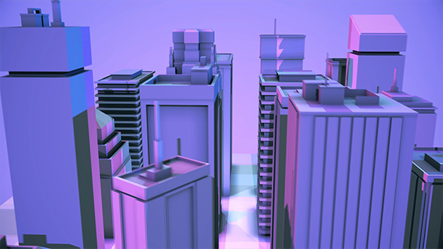
Architectural Design of Buildings
But 3D modeling is not by any means out of favor for architectural design. On the contrary, the capability for complex, detailed, and advanced design is greater than ever.
Tourist and Leisure Activities
A successful city is one that people not only live and work in but also visit and spend leisure time. 3D modeling helps here, allowing for careful design of aspects like pools, tourist attractions, public venues for concerts, and more.
3D Cadasters
As cities become highly populated, recording where property lines begin, and the end is critical for real estate evaluation and building permissions. Luckily, city officials no longer need to rely just on paper maps but can store their cadasters in three dimensions through modeling.
Roadway Planning
What good is a city without being able to move around within it? Advanced 3D modeling allows city planners and transportation engineers to plan out where roads will go, how traffic will operate, and more to allow for efficient and safe travel.

The Power of Simulation to Track Smart City Maintenance Needs
Cities are not static fixtures; they are dynamic and ever-evolving entities. For that reason, 3D modeling gets you a good start for how a city will look, but simulation is necessary to see how aspects of the city will grow, change, and require maintenance by city officials. There is one such example of Google and the University of Michigan coming together to Identify 55K homes with water contamination problems using AI-based technology. Other similar scenarios are as follows:
- Environmental simulations (vegetation) When designing landscapes and green spaces, it’s important to remember that plants grow, die, and require maintenance. Using state-of-the-art simulation tools, you can ensure this will all happen safely, and work will be done where and when it’s needed, preventing dangerous trees from falling, for example.
- Vehicle and pedestrian navigation Similarly, 3D models can set up how roadways and sidewalks will look, but only through smart city simulation can you determine how the flow of traffic will look on the worst-case scenario. By ensuring roads and pathways have the capacity to take on that traffic safely and efficiently, a city stays ahead of the game.
- Overshadowing and sunlight exposure for aligning new buildings Natural light pouring in through a window is immensely desirable for real estate. Designing a single building is an incomplete look at these properties, though, as it requires full city modeling and simulation of sun behavior over the course of a day and year to see where overshadowing or overexposure to sunlight may become an issue.
- Solar potential of buildings In the exact same way, the availability of sunlight to hit a rooftop solar power installation. Simulating the path of the sun and interaction from shadows of other buildings will uncover the best designs to maximize solar energy potential.
Sustainability in the City of Tomorrow: A 3D Modeling Priority
All cities are really looking towards the future these days, which is why smart cities are so important. Sustainability of space, resources, and services is critical to a highly desirable smart city, and 3D modeling is a key tool in that regard.
- Measuring land use As cities grow in population, making sure the land is used efficiently and most effectively is a top priority. 3D modeling as a sustainable city will ensure proper distribution of resources and availability of, for example, green spaces.
- Land vs. population The simulation tools available will also track what happens as the populations of those cities naturally grow to make sure the capacity is sufficient with enough lead time.
- Housing density Ensuring the safe and proper housing for all of a city’s citizens is an uncompromisable priority of the sustainable city of tomorrow. The virtual modeling and simulation tools open the doors to this type of planning.
- Building height A tool for expanding to fit a growing population is examining various building height allowances and what that would mean for not only population growth but side impacts like solar availability, emergency safety planning, and more.
- Floor area ratio Floor area ratio is another measure to watch as cities grow in size, undercutting a denser population, and what that means for forward-looking city officials.
- Renewable energy The sustainable city of the future is synonymous with renewable energy, and adequate land and roof space need to be modeled for solar power installations, microgrids, and other clean energy solutions.
Moving Forward on the Path to the City of Tomorrow
Soon, the futuristic cities that only seemed possible in the movies will be a reality in every geography. But these transformations won’t happen automatically or overnight, and rather they require careful design and planning using the virtual tools we have in 3D modeling, simulation software, and smart city technologies.
These opportunities are all that IndiaCADworks (ICW) is skilled in, and if you’re looking to investigate smart city planning and design, we can put our many years of expert architectural 3D modeling, simulation, and land development service experience to work for you. So, what are you waiting for? Call us today to get started!
– IndiaCADworks

