Scan to BIM Services for Accurate Existing-Condition Intelligence
Renovation and retrofit programs break down when design and coordination rely on unverified existing conditions. In brownfield environments, undocumented modifications and concealed services introduce tolerance errors that drive RFIs, field rework, and schedule volatility.
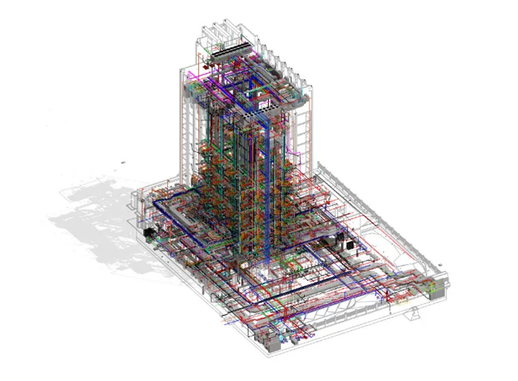
IndiaCADworks’ scan to BIM services transform raw point cloud data into LOD-defined, tolerance-verified digital representations that support design coordination, MEP reconstruction, prefabrication planning, and facility lifecycle management. Architectural, structural, and MEP systems are reconstructed through parametric workflows aligned to defined use cases, with geometry governed by agreed tolerance thresholds and multi-stage QA checks.
The outcome is engineering-grade intelligence on existing conditions that reduces RFIs, limits site-driven changes, shortens retrofit design cycles, and enables confident construction, coordination, and lifecycle planning decisions.
-
Need a Custom Quote?
- Contact Form
- Live Chat
- Email Us
- 855-259-3709
What Our Scan to BIM Engagement Delivers
We provide production-grade models aligned with project use cases, not generic geometry exports.
LOD-Based Model Development
We develop models at LOD 200-500 depending on the project stage and requirements:
| LOD | Use Case | How We Model |
|---|---|---|
| 200 | Concept retrofit feasibility | Approximate geometry, spatial envelopes, major system zones, and primary structural elements derived from point cloud data |
| 300 | Coordination and clash detection | Accurate system geometry for architectural, structural, and MEP elements with defined locations and sizes |
| 350 | Trade interface detailing | Enhanced modeling at system interfaces, penetrations, equipment connections, and critical coordination zones |
| 400 | Fabrication-level modeling | Fabrication-ready geometry for selected systems, including supports, connections, and installation intent |
| 500 | Verified as-built asset record | Field-verified geometry aligned to reality capture, with asset tagging and metadata where required |
Reality Capture Data Engineering & Accuracy Governance
Model reliability begins before modeling starts. Point cloud datasets from terrestrial, mobile, and SLAM scanners are validated prior to reconstruction to ensure that geometry development is based on qualified capture data rather than assumed accuracy.
We perform:
- Point cloud registration validation and alignment consistency checks
- Density adequacy review relative to modeling tolerance targets
- Coverage gap identification and line-of-sight limitation assessment
- Noise filtering, segmentation, and cloud optimization for modeling workflows
- Accuracy qualification to determine the achievable LOD and tolerance feasibility
These controls define whether the dataset supports coordination-grade modeling and prevent unreliable scan conditions from propagating into downstream BIM services production.
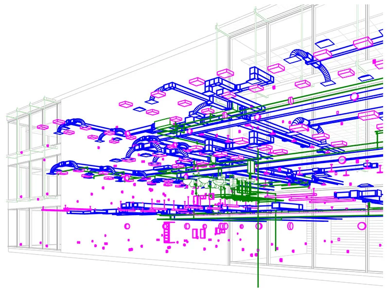
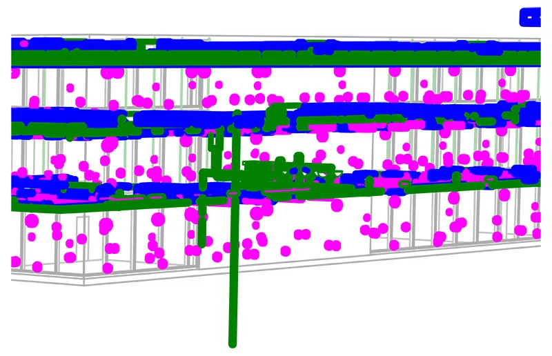
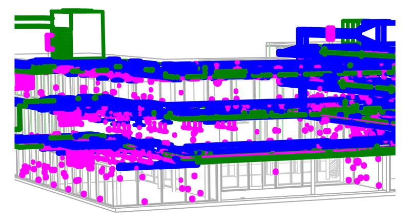
Point Cloud to Parametric BIM Modeling
Parametric reconstruction is performed from validated point cloud data, so the modeled geometry reflects qualified existing conditions rather than visual approximation. Architectural, structural, and MEP systems are developed as intelligent objects aligned with defined LOD requirements and project tolerance thresholds. Model development is executed in Autodesk Revit, with coordination validation and spatial checks performed in Navisworks.
We perform:
- Object-based reconstruction from registered point clouds
- Parametric family development aligned with LOD and tolerance targets
- System classification for coordination and engineering use
- Ongoing spatial validation against point cloud references
Retrofit-critical systems, concealed services, and plant areas receive selective detailing where coordination risk and shutdown impact are highest.
Deviation and Verification Analysis
We compare design models against reality-captured models to identify:
- Structural deflections
- Construction deviations
- Installation misalignments
- Clearance issues
This supports dispute resolution, compliance checks, and project validation.
Asset Data and FM-Ready Models
We structure BIM models to support lifecycle operations:
- Asset tagging
- Equipment metadata integration
- COBie-ready data structures
- System classification for maintenance planning
This bridges project delivery with facility management systems and digital twin initiatives.
Our Structured Scan to BIM Workflow
Our Scan to BIM process is engineered for accuracy, scalability, and project integration.
- Data Validation – We verify scan coverage, registration quality, and spatial consistency.
- Cloud Optimization – Point cloud segmentation, cleanup, and structuring for modeling workflows.
- Engineering-Led Modeling – Parametric object creation aligned with LOD and use case requirements.
- Model QA and Coordination – Clash checks, geometry validation, tolerance reviews, and deliverable standardization.
- Information Structuring – Asset data embedding and classification.
Each stage is reviewed against agreed LOD definitions, tolerance thresholds, and BIM execution requirements before progression.
-
Need Pricing Details?
- Contact Form
- Live Chat
- Email Us
- 855-259-3709
Where Our Services Are Used
Our models support:
- Hospital upgrades
- Industrial facility modernization
- Commercial building retrofits
- Infrastructure rehabilitation
- Heritage restoration
- Plant and process facility reconfiguration
Business Outcomes of Our Scan to BIM Services
- Lower construction rework risk
- Fewer RFIs related to site conditions
- Faster retrofit design cycles
- Reduced project contingency allowances
- Better facility data for operations
- Improved capital planning accuracy
These outcomes are based on aggregated retrofit and modernization project experience where structured QA, LOD controls, and tolerance alignment were applied.
Engage with a Team That Understands Both Geometry and Engineering
Our scan to BIM engagements deliver LOD-defined, tolerance-qualified models governed by structured validation and QA controls, so downstream coordination, fabrication planning, and asset records are based on reliable inputs with clear reliance boundaries.
Partner with specialists in point cloud scan to BIM conversion who understand how geometry becomes constructible information.
-
Start with a Free Trial?
- Contact Form
- Live Chat
- Email Us
- 855-259-3709
Frequently Asked Questions
Models are delivered from LOD 200 to LOD 500 based on agreed project use cases. LOD definitions are aligned before modeling begins to ensure that outputs align with coordination, retrofit planning, fabrication, or asset record requirements.
Model geometry is developed against registered point cloud data and reviewed against agreed tolerance thresholds. Achievable accuracy depends on scan density, site conditions, and control point quality.
Where full visibility is not available, systems are reconstructed using engineering interpretation supported by scan data and available documentation. Destructive verification or physical exposure is outside standard modeling scope unless separately defined.
Standard deliverables include RVT, NWC or NWD, IFC, and, where required, structured data outputs. Model structuring aligns with project BIM execution and coordination platform requirements.
Datasets are segmented, optimized, and structured before modeling to maintain performance and usability while preserving the geometry necessary for engineering and coordination decisions.
Quality control includes point cloud registration review, geometry validation, clash checks where applicable, alignment verification, and standards compliance review against defined project requirements.